By: Ali Usman, Cultural Tutor “Pamong Budaya” in the Department of Tourism, Culture and Youth Sports of Bangka Belitung Island
Translator : Siti Afrinda Syelsega, S. Hum
Bekaespedia.com_Have you ever wondered what the city of Toboali was like in 1930s? Was the Pineapple monument or the National Building already there? Not yet, perhaps. What is certain is that Toboali Fort has already stood firmly. Let’s go! Let’s reminisce about the past, “Habang Tempo Doeloe”!
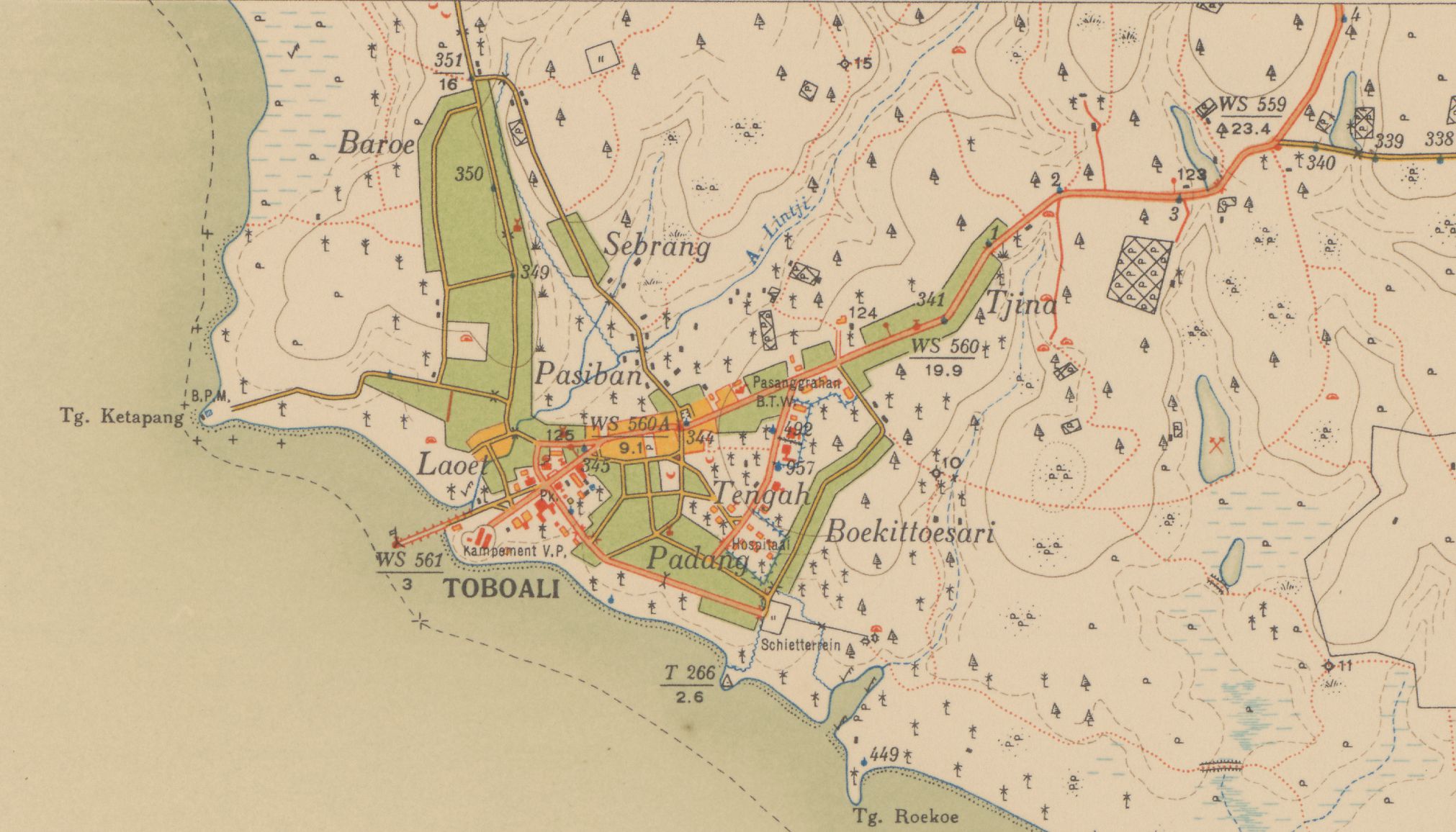
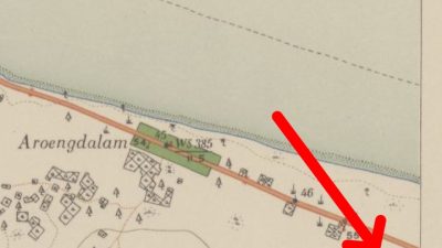
In a Resident Map of Bangka “en Onderh Blad 25/XXVIIId” published by the Dutch East Indies Topographic Service in 1934, the governance of Toboali city area was divided into 4 areas which were trade, government, mining administration and settlement. The trade area was on the edge of main road connecting the port – BTW area directing to Pangkalpinang, colored in orange and the center was at the market (colored in white with black stripes, surrounded by roads). The area was dominated by houses with Chinese architecture which functioned as stores and residences for Chinese people. The pattern was similar to markets in Belinyu and Koba which were located on the edge of main road, unlike those in Pangkalpinang, Sungailiat and Mentok which located on the edge or near a river.
The government area was in Toboali Fort area, around the intersection 5 and the end of main road leading to the Toboali pier. This area was marked in white. Some buildings were permanent/steenen (colored in red), some were semi-permanent/houten (in yellow) and some were wooden (in black). Permanent buildings included Kampement Veldpolitie (Toboali Fort), Controleur/Wedana Official House, Poskantoor (Post Office), Toboali “Pegadaian” Pawnshop, Dewi Sin Mu Temple and an old Toboali Bakti Timah Clinic building. Meanwhile, semi-permanent buildings included two houses with a permanent rear building (regional finance agency “UPTB Bakuda Office”), two buildings around Toboali “Pegadaian” Pawnshop, one building in front of Al Ihsan Mosque, one building next to a temple (which was a warehouse), two buildings around the Toboali Bakti Timah Clinic building, one building behind the post office, two buildings behind Wedana’s house and one building at the end of the road to the pier. The wooden buildings included three buildings around the old clinic, one building next to two the semi-permanent houses and one building next to the road leading to the pier. In total, there were 23 buildings.
The tin mining administration area was in Tengah Village, not on the main road, connected to a secondary road leading to Padang Village, marked in white, and the position was on the hills (similar to Baru Hill) and several buildings were there (permanent, semi-permanent, wooden). There were three permanent buildings (Buildings I, II, and III), four semi-permanent buildings on the edge of main road and secondary road to the hill “Bukit”, two semi-permanent buildings next to Building I, one semi-permanent building next to Building III, three semi-permanent buildings around the intersection in front of the Hospital and eight semi-permanent buildings at the Hospitaal (Hospital) and two wooden buildings in front of Building III. In total, there were 21 buildings which function as the BTW office for Toboali region, an official residence for the Head of BTW Toboali, a residence for BTW officials, hospitals and houses for Malays. Meanwhile, Pesanggrahan BTW was located separately on the edge of main road.
Settlement patterns were divided into three zones, namely Melayu Village, China Village and European elite settlements. Melayu Village was marked green, connected by the secondary road and there were signs of a mosque and cemetery. Melayu Village included some small villages namely Laoet, Padang, Boekittoesari, Tengah, Pasiban, Sebrang and Baroe. There were three permanent mosque buildings in Pasiban (Al Ihsan Mosque), Padang (Al Munawar Mosque) and Baroe (Ar Raihan Mosque). There were three cemeteries at each end of Baroe, Padang and Tengah villages. Chinese village was marked orange, located on the edge of Aik Lintji Kampong Laoet (Batu Licin) and on either side of the main road around the market. There was only one permanent place for worship (Dewi Sin Mu Temple) and nine Chinese cemeteries (Pendem) scattered around Toboali City. European elite settlements were marked in white and there were buildings that functioned as a government center and a mining administration center. European elite settlements were located in 2 locations, Toboali Fort area and Tengah Village area (Wilasi PN TTB/Toboali PT Timah Unit)
So, it’s answered, isn’t it? The Pineapple Monument and the National Building had not yet existed at that time. PT Timah Guest House, KONI South Bangka Building, Tennis Court and GPIB Efrata Church also had not yet been there. Do you know when the PT Timah Guest House was built?

